The field of crisis mapping is a relatively new field, but there’s no denying that it’s growing and having a significant impact on the world. The advantages of crisis mapping are extensive: they offer a way for information to be published directly and instantly from the target region (called crowd-sourcing), they allow for massive amounts of information to be quickly understood by any interested parties, and if properly put together, allows for quicker responses during a crisis.
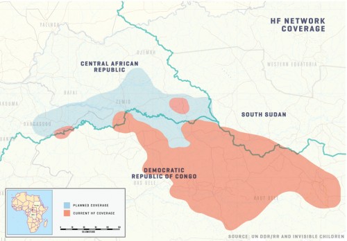
Invisible Children ventured into this field with the launch of the LRA Crisis Tracker in 2011. The Crisis Tracker was inspired by Ushahidi, the free, build-your-own crisis mapping website. Ushahidi has hosted some of the most influential crisis maps to date. Despite this source of inspiration, the Crisis Tracker still faced the unique problem of how to get reliable reports from a region that has very little cell phone and internet access and very few roads, many of which can be rendered inaccessible depending on the weather. The solution to this problem, in large part, was found in Invisible Children’s expansion of a locally-run High Frequency (HF) Radio Network. The Network gathers reports from 32 HF radios in communities across the northeastern region of the Democratic Republic of Congo and the southeastern region of the Central African Republic, serving first and foremost as an early warning system to communities at risk of LRA attack. The radio operators, all locally recruited volunteers, report in twice a day to a hub in Dungu, which in turn forwards a daily report to the US IC office in San Diego.

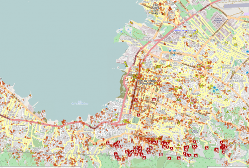
Before the Crisis Tracker existed, there were many other crisis maps having a huge impact on the world. One of the more famous examples is the Haiti crisis map. After the devastating earthquake, volunteers from all over the world rallied together to help map the devastation so that first-responders would know what help was needed and where. For a full write-up on Haiti crisis map click here.
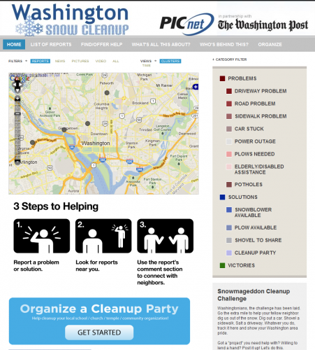
However, crisis maps are not limited to massive disasters. They can range from organizing the population of Washington D.C. to clean up their city after a large snow storm or they can be used as an accountability tool when a county gains its independence and votes for the first time.
All these various maps provide a wealth of information and are useful to specific groups of people, but they can tend to be overwhelming for those unfamiliar with the field or the particular crisis. This is the gap that Invisible Children has tried to bridge with the LRA Crisis Tracker. As Director of Programs Adam Finck stated at the 3rd Annual International Crisis Mappers Conference last year: “To be able to create a tool…that’s made for the pros but is accessible enough to be able to permeate the mainstream.” With that as the intention, the LRA Crisis Tracker was born.
As mentioned earlier, the Crisis Tracker combines real-time reports from Invisible Children’s HF Radio Network with other reports from our partners on the ground to bring the activities of the LRA into the public sphere as soon as incidences occur. Its intuitive design and inclusion of photos and videos from the region makes the information presented on the site easily accessible and helps connect people to the reality of the crisis. For the tech-savvy, there are free iPhone and Android apps available and the Crisis Tracker also regularly tweets out incidents as they are reported. You can follow the Crisis Tracker here.
-contributed by John Beaton, Crisis Tracker Project Developer


Think people should hear about this?